
Dataset Catalog
Table of Contents
Attention: These maps were prepared for the inventory of real property based on the utilization of deeds, plans, and/or supportive data. In addition, map files are frequently changed to reflect changes in boundaries, lot lines and other geographic features resulting from changes in ownership, development, and other causes. The existence, dimension, and location of features, as well as other information, should not be relied upon for any purpose without actual field verification. The County of Boone makes no warranty of any kind concerning the completeness or accuracy of information contained on these maps and assumes no liability or responsibility for the use or reuse of these maps by persons not affiliated with Boone County. Use of these maps by any person not affiliated with Boone County constitutes agreement by the user to assume full liability and responsibility for the verification of the accuracy of information shown on these maps.
Click here to view the entire Boone County GIS and Digital Data Price List
Address Dataset
Address Dataset
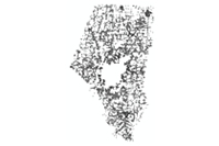
Description: Situs address points for areas outside of the City of Columbia.
Distribution: Dataset may be purchased from the Boone County GIS Department.
$150
County Clerk Datasets
Precincts Class
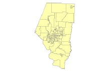
Description: A polygon layer of voter precincts in Boone County.
Metadata:
Distribution: Dataset may be purchased from the Boone County GIS Department.
$20
Elevation Datasets
2019 1' Digital Elevation Model (DEM) Raster
Description: An overall county-extent 1' elevation model as a ESRI Raster dataset. The 1' DEM that was derived from the 2019 LiDAR and associated as-needed hydro-flattening.
Metadata:
Distribution: Dataset may be purchased from the Boone County Assessor's Office.
$255
2019 Hillshade Raster
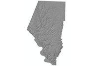
Description: An overall county-extent 1' Hillshade as a ESRI Raster dataset. The Hillshade was developed using the focal statistic output from the 1' DEM that was derived from the 2019 LiDAR and associated as-needed hydro-flattening to derive a smoothed yet accurate hillshade.
Metadata:
Distribution: Dataset may be purchased from the Boone County Assessor's Office.
$255
2019 LiDAR Fully Classified LAS
Description: LiDAR (Light Detection and Ranging) elevation data captured in 2019 at 0.7m spacing.
Metadata:
Distribution: Raw LAS files with associated hydro enforced breaklines may be purchased from the Boone County Assessor's Office.
$15 per tile
2015 1' Digital Elevation Model (DEM) Raster
Description: An overall county-extent 1' elevation model as a ESRI Raster dataset. The 1' DEM that was derived from the 2015 LiDAR and associated as-needed hydro-flattening.
Metadata:
Distribution: Dataset may be purchased from the Boone County Assessor's Office.
$255
2015 Hillshade Raster
Description: An overall county-extent 1' Hillshade as a ESRI Raster dataset. The Hillshade was developed using the focal statistic output from the 1' DEM that was derived from the 2015 LiDAR and associated as-needed hydro-flattening to derive a smoothed yet accurate hillshade.
Metadata:
Distribution: Dataset may be purchased from the Boone County Assessor's Office.
$255
2015 LiDAR Fully Classified LAS
Description: LiDAR (Light Detection and Ranging) elevation data captured in 2015 at 0.7m spacing.
Metadata:
Distribution: Raw LAS files with associated hydro enforced breaklines may be purchased from the Boone County Assessor's Office.
$15 per tile
2009 1' Digital Elevation Model (DEM) Raster
Description: An overall county-extent 1' elevation model as a ESRI Raster dataset. The 1' DEM that was derived from the 2009 LiDAR and associated as-needed hydro-enforced monotonic breaklines.
Distribution: Dataset may be purchased from the Boone County Assessor's Office.
$255
2009 Hillshade Raster
Description: An overall county-extent 1' Hillshade as a ESRI Raster dataset. The Hillshade was developed using the focal statistic output from the 1' DEM that was derived from the 2009 LiDAR and associated as-needed hydro-enforced monotonic breaklines to derive a smoothed yet accurate hillshade.
Distribution: Dataset may be purchased from the Boone County Assessor's Office.
$255
2009 LiDAR Fully Classified LAS
Description: LiDAR (Light Detection and Ranging) elevation data captured in 2009 at 1.4m spacing.
Metadata:
Distribution: Raw LAS files with associated hydro enforced breaklines may be purchased from the Boone County Assessor's Office.
$15 per tile
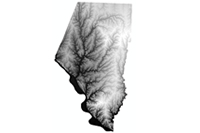
Environmental Dataset
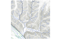
Streams Class
Description: Streams, creeks, lakes, ponds in Boone County stored as lines. Digitized from County Assessor's Mylar Parcel Maps (scales of 1"=100', =200', =400'). Major water bodies attributed with their proper name.
Metadata:
- Streams Class Environmental Dataset: FGDC Outline (For more information about FGDC, please visit our Frequently Asked Questions page.)
- Streams Class Environmental Dataset: XML
Distribution: Dataset may be purchased from the Boone County Assessor's Office.
$20
Water Districts Class
Description: A polygon layer of water districts in Boone County.
Metadata:
- Water Districts Class Environmental Dataset: FGDC Outline (For more information about FGDC, please visit our Frequently Asked Questions page.)
- Water Districts Class Environmental Dataset: XML
Distribution: Dataset may be purchased from the Boone County Assessor's Office.
$20
Imagery Datasets
2019 Color Orthophoto
Description: An overall county-extent mosaic image of aerial orthophoto tiffs. The 100-scale (6" pixels) tiffs were mosaiced together into a SDE Raster dataset.
Metadata:
Distribution: Dataset may be purchased from the Boone County Assessor's Office.
$15 per tile TIF
$85 per 1/3 County MrSID tile
$255 per County-wide MrSID set
2015 Color Orthophoto
Description: An overall county-extent mosaic image of aerial orthophoto tiffs. The 100-scale (6" pixels) tiffs were mosaiced together into a SDE Raster dataset.
Metadata:
Distribution: Dataset may be purchased from the Boone County Assessor's Office.
$15 per tile TIF
$85 per 1/3 County MrSID tile
$255 per County-wide MrSID set
2011 Color Orthophoto
Description: An overall county-extent mosaic image of aerial orthophoto tiffs. The 100-scale (6" pixels) tiffs were mosaiced together into a SDE Raster dataset.
Metadata:
Distribution: Dataset may be purchased from the Boone County Assessor's Office.
$15 per tile TIF
$85 per 1/3 County MrSID tile
$255 per County-wide MrSID set
2007 Color Orthophoto
Description: An overall county-extent mosaic image of aerial orthophoto tiffs. The 100-scale (6" pixels) tiffs were mosaiced together into a SDE Raster dataset.
Distribution: Dataset may be purchased from the Boone County Assessor's Office.
$15 per tile TIF
$85 per 1/3 County MrSID tile
$255 per County-wide MrSID set
2002 Color Orthophoto
Description: An overall county-extent mosaic image of aerial orthophoto tiffs. The 100-scale (6" pixels) and 200-scale (1' pixels) tiffs were mosaiced together into a SDE Raster dataset.
Metadata:
- 2002 Color Orthophoto Imagery Dataset: FGDC Outline (For more information about FGDC, please visit our Frequently Asked Questions page.)
- 2002 Color Orthophoto Imagery Dataset: XML
Distribution: Dataset may be purchased from the Boone County Assessor's Office.
$15 per tile TIF
$85 per County-wide MrSID set
Municipal Datasets
City Class
Description: A polygon layer of city limits areas in Boone County. Includes Ashland, Centralia, Columbia, Hallsville, Harrisburg, Hartsburg, Huntsdale, McBaine, Rocheport, Sturgeon.
Metadata:
- City Class Municipal Dataset: FGDC Outline (For more information about FGDC, please visit our Frequently Asked Questions page.)
- City Class Municipal Dataset: XML
Distribution: Dataset may be purchased from the Boone County Assessor's Office.
$20
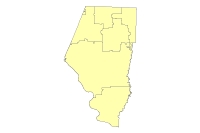
Civil Townships Class
Description: Official civil/political townships stored as polygons. Includes Bourbon, Cedar, Centralia, Columbia, Katy, Missouri, Perche, Rock Bridge, Rocky Fork, Three Creeks.
Metadata:
- Civil Townships Class Municipal Dataset: FGDC Outline (For more information about FGDC, please visit our Frequently Asked Questions page.)
- Civil Townships Class Municipal Dataset: XML
Distribution: Dataset may be purchased from the Boone County Assessor's Office.
$20
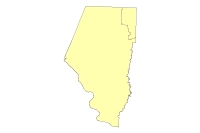
County Boundaries Class
Description: The boundary of the County of Boone as a polygon.
Metadata:
- County Boundaries Class Municipal Dataset: FGDC Outline (For more information about FGDC, please visit our Frequently Asked Questions page.)
- County Boundaries Class Municipal Dataset: XML
Distribution: Dataset may be purchased from the Boone County Assessor's Office.
$15
Library Districts Class
Description: Library tax districts stored as polygons.
Metadata:
- Library Districts Class Municipal Dataset: FGDC Outline (For more information about FGDC, please visit our Frequently Asked Questions page.)
- Library Districts Class Municipal Dataset: XML
Distribution: Dataset may be purchased from the Boone County Assessor's Office.
$15
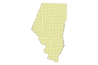
Map Sheet Class
Description: Boone County Assessor's Office area reference grid for parcels, based on scale. There are 1"=100' mapsheets, 1"=200' mapsheets, and 1"=400' mapsheets. The mapsheet number is part of the parcel number.
Metadata:
- Map Sheet Class Municipal Dataset: FGDC Outline (For more information about FGDC, please visit our Frequently Asked Questions page.)
- Map Sheet Class Municipal Dataset: XML
Distribution: Dataset may be purchased from the Boone County Assessor's Office.
$70
School District Class
Description: Boone County Assessor's Office area reference grid for parcels, based on scale. There are 1"=100' mapsheets, 1"=200' mapsheets, and 1"=400' mapsheets. The mapsheet number is part of the parcel number.
Metadata:
- School District Class Municipal Dataset: FGDC Outline (For more information about FGDC, please visit our Frequently Asked Questions page.)
- School District Class Municipal Dataset: XML
Distribution: Dataset may be purchased from the Boone County Assessor's Office.
$20
Subdivisions Class
Description: Subdivision boundaries stored as polygons. Subdivision existence and numbering make up part of the parcel number.
Metadata:
- Subdivisions Class Municipal Dataset: FGDC Outline (For more information about FGDC, please visit our Frequently Asked Questions page.)
- Subdivisions Class Municipal Dataset: XML
Distribution: Dataset may be purchased from the Boone County Assessor's Office.
$325
Townships Class
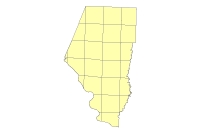
Description: Polygon layer of Boone County Assessor's Office area reference grid for parcels, based on township and range lines. Each "township" has a unique number, 1 to 28. Numbering starts in the upper left corner of the county and increases from left to right, top to bottom.
Metadata:
- Townships Class Municipal Dataset: FGDC Outline (For more information about FGDC, please visit our Frequently Asked Questions page.)
- Townships Class Municipal Dataset: XML
Distribution: Dataset may be purchased from the Boone County Assessor's Office.
$15
Ownership Datasets
Assessor AA Table
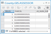
Description: A table representing the Assessor's Assessment Administration (AA) file. It contains parcel information ranging from real estate owners' names and addresses to taxation districts to legal description and deed reference information to appraised, assessed, and BOE (Board of Equalization) values. Parcel number field is the common link between AA information and GIS features.
Metadata:
- Assessor AA Table Ownership Dataset: FGDC Outline (For more information about FGDC, please visit our Frequently Asked Questions page.)
- Assessor AA Table Ownership Dataset: XML
Distribution: Dataset may be purchased from the Boone County Assessor's Office.
$25
Parcel Datasets
Condo1_Poly Class

Description: A polygon layer of condominium units that have individual parcel numbers. These are condo units that are on the first floor of the building.
Metadata:
- Condo1_Poly ClassCondo2_Poly Class Parcel Dataset: FGDC Outline (For more information about FGDC, please visit our Frequently Asked Questions page.)
- Condo1_Poly ClassCondo2_Poly Class Parcel Dataset: XML
Distribution: Dataset may be purchased from the Boone County Assessor's Office.
$10
Condo2_Poly Class

Description: A polygon layer of condominium units that have individual parcel numbers. These are condo units that are on the second floor of the building.
Metadata:
- Condo2_Poly Class Parcel Dataset: FGDC Outline (For more information about FGDC, please visit our Frequently Asked Questions page.)
- Condo2_Poly Class Parcel Dataset: XML
Distribution: Dataset may be purchased from the Boone County Assessor's Office.
$10
Condo3_Poly Class

Description: A polygon layer of condominium units that have individual parcel numbers. These are condo units that are on the third floor of the building.
Metadata:
- Condo3_Poly Class Parcel Dataset: FGDC Outline (For more information about FGDC, please visit our Frequently Asked Questions page.)
- Condo3_Poly Class Parcel Dataset: XML
Distribution: Dataset may be purchased from the Boone County Assessor's Office.
$10
Condo4_Poly Class
Description: A polygon layer of condominium units that have individual parcel numbers. These are condo units that are on the forth floor of the building.
Metadata:
- Condo4_Poly Class Parcel Dataset: FGDC Outline (For more information about FGDC, please visit our Frequently Asked Questions page.)
- Condo4_Poly Class Parcel Dataset: XML
Distribution: Dataset may be purchased from the Boone County Assessor's Office.
$10
CondoB_Poly Class

Description: A polygon layer of condominium units that have individual parcel numbers. These are condo units that are on the basement floor of the building.
Metadata:
- CondoB_Poly Class Parcel Dataset: FGDC Outline (For more information about FGDC, please visit our Frequently Asked Questions page.)
- CondoB_Poly Class Parcel Dataset: XML
Distribution: Dataset may be purchased from the Boone County Assessor's Office.
$10
Parcel Annotation Class
Description: Parcel lot dimesions stored as an annotation class. Annotation sizes are based on one of three scales (1"=100'; 1"=200'; or 1"=400').
Metadata:
- Parcel Annotation Class Parcel Dataset: FGDC Outline (For more information about FGDC, please visit our Frequently Asked Questions page.)
- Parcel Annotation Class Parcel Dataset: XML
Distribution: Dataset may be purchased from the Boone County Assessor's Office.
$1,000
Parcel Cartography Class

Description: Cartographic symbols representing multipart/common ownership parcel features. Also known as land hooks or tie bars.
Metadata:
- Parcel Cartography Class Parcel Dataset: FGDC Outline (For more information about FGDC, please visit our Frequently Asked Questions page.)
- Parcel Cartography Class Parcel Dataset: XML
Distribution: Dataset may be purchased from the Boone County Assessor's Office.
$15
Parcel Line Class
Description: Tax parcel boundaries stored as lines. Built on the ArcGIS parcel data line model.
Metadata:
- Parcel Line Class Parcel Dataset: FGDC Outline (For more information about FGDC, please visit our Frequently Asked Questions page.)
- Parcel Line Class Parcel Dataset: XML
Distribution: Dataset may be purchased from the Boone County Assessor's Office.
$1,400
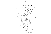
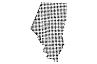
Parcel Points Class
Description: Label points for parcels. Points contain parcel number attribute.
Metadata:
- Parcel Points Class Parcel Dataset: FGDC Outline (For more information about FGDC, please visit our Frequently Asked Questions page.)
- Parcel Points Class Parcel Dataset: XML
Distribution: Dataset may be purchased from the Boone County Assessor's Office.
$150
Parcel Polygon Class
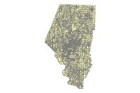
Description: Tax parcel boundaries stored as polygons.
Metadata:
- Parcel Polygon Class Parcel Dataset: FGDC Outline (For more information about FGDC, please visit our Frequently Asked Questions page.)
- Parcel Polygon Class Parcel Dataset: XML
Distribution: Dataset may be purchased from the Boone County Assessor's Office.
$1,300
Survey Datasets
Monument Point Class
Description: Survey control monument points for Boone County. Most of them are first order monuments from the Missouri Department of Natural Resources.
Metadata:
- Monument Point Class Survey Dataset: FGDC Outline (For more information about FGDC, please visit our Frequently Asked Questions page.)
- Monument Point Class Survey Dataset: XML
Distribution: Dataset may be purchased from the Boone County GIS Department.
$10
PLSS Points Class
Description: A layer of points representing intersections (nodes) of PLSS section lines.
Metadata:
- PLSS Points Class Survey Dataset: FGDC Outline (For more information about FGDC, please visit our Frequently Asked Questions page.)
- PLSS Points Class Survey Dataset: XML
Distribution: Dataset may be purchased from the Boone County Assessor's Office.
$70
Section Township Range Class
Description: PLSS sections stored as polygons. Includes attributes of section numbers, township numbers, and range numbers.
Metadata:
- Section Township Range Class Survey Dataset: FGDC Outline (For more information about FGDC, please visit our Frequently Asked Questions page.)
- Section Township Range Class Survey Dataset: XML
Distribution: Dataset may be purchased from the Boone County Assessor's Office.
$10
Survey Districts Class
Description: A polygon layer of survey districts with their corresponding number.
Metadata:
- Survey Districts Class Survey Dataset: FGDC Outline (For more information about FGDC, please visit our Frequently Asked Questions page.)
- Survey Districts Class Survey Dataset: XML
Distribution: Dataset may be purchased from the Boone County Assessor's Office.
$10
Topographic and Planimetric Datasets
2015 or 2009 Topographic and Planimetrics
Description: Includes 2' contours, structures, hydro breaklines, DEM, Hillshade, & DSM for areas outside the City of Columbia metro area.
Distribution: Dataset may be purchased from the Boone County Assessor's Office.
$125 per 2500' x 2500' tile
Structures
Description: Structure footprints as polygons for areas outside the City of Columbia metro area.
Distribution: Dataset may be purchased from the Boone County Assessor's Office.
$100
Transportation Datasets
Abandoned Railroad Class

Description: Right-of-way of abandoned railroads in Boone County, stored as polygons.
Metadata:
- Abandoned Railroad Class Transportation Dataset: FGDC Outline (For more information about FGDC, please visit our Frequently Asked Questions page.)
- Abandoned Railroad Class Transportation Dataset: XML
Distribution: Dataset may be purchased from the Boone County Assessor's Office.
$10
Abandoned Railroad Centerline Class

Description: Centerlines of abandoned railroads in Boone County.
Metadata:
- Abandoned Railroad Centerline Class Transportation Dataset: FGDC Outline (For more information about FGDC, please visit our Frequently Asked Questions page.)
- Abandoned Railroad Centerline Class Transportation Dataset: XML
Distribution: Dataset may be purchased from the Boone County Assessor's Office.
$10
MKT/Katy Trail Class
Description: Polygon layer of the MKT and Katy trails in Boone County.
Metadata:
- MKT/Katy Trail Class Transportation Dataset: FGDC Outline (For more information about FGDC, please visit our Frequently Asked Questions page.)
- MKT/Katy Trail Class Transportation Dataset: XML
Distribution: Dataset may be purchased from the Boone County Assessor's Office.
$10
Railroad Class
Description: Polygon layer of railroad right-of-way in Boone County.
Metadata:
- Railroad Class Transportation Dataset: FGDC Outline (For more information about FGDC, please visit our Frequently Asked Questions page.)
- Railroad Class Transportation Dataset: XML
Distribution: Dataset may be purchased from the Boone County Assessor's Office.
$10
Railroad Centerline Class

Description: Centerlines of railroads in Boone County.
Metadata:
- Railroad Centerline Class Transportation Dataset: FGDC Outline (For more information about FGDC, please visit our Frequently Asked Questions page.)
- Railroad Centerline Class Transportation Dataset: XML
Distribution: Dataset may be purchased from the Boone County Assessor's Office.
$10
Road Districts Class
Description: Road Districts in Boone County, stored as polygons.
Metadata:
- Road Districts Class Transportation Dataset: FGDC Outline (For more information about FGDC, please visit our Frequently Asked Questions page.)
- Road Districts Class Transportation Dataset: XML
Distribution: Dataset may be purchased from the Boone County Assessor's Office.
$15
Roads Class
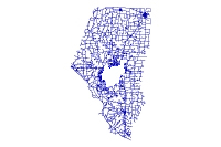
Description: Centerlines of all roads in Boone County, including city streets, county roads, highways, etc. Attributes include names, enhanced address ranges, zip codes, etc.
Metadata:
- Roads Class Transportation Dataset: FGDC Outline (For more information about FGDC, please visit our Frequently Asked Questions page.)
- Roads Class Transportation Dataset: XML
Distribution: Dataset may be purchased from the Boone County GIS Department.
$250